
 |
Home | Mera Peak Main | Contact |
Last Updated: January 2010. Click on an image to see the FULL size with a caption.
The times shown are the actual trekking times including photo stops, but not including rest or lunch stops. The altitudes are mainly from Lonely Planet.
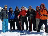
My crew at the West Col:
Climbing Sherpa Palde (his fourth time with me), Cook Pemba Rinjii - fifth time, porter Pal Dorje - second time, Jerome Ryan, Guide Gyan Tamang - eighth time, porter Tenzing - second time, and cook's helper Pasang - second time.
The routine is almost the same each day. I get up around 5:30; bed milk-tea is at 6:00 followed by washing water at 6:15 and breakfast at 6:30. We are on the trail around 7:00, reaching our lunch spot after three to four hours. The afternoon trek is shorter, around two to three hours. I then read a book and have afternoon milk-tea and cookies. Soup and a snack like papadam or popcorn is served around 18:00, followed by dinner. When the crew starts to eat their dinner, usually dhal bhat, I head for bed around 19:00.
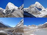
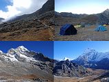
After trekking to Makalu Base Camp South and crossing the East and West Cols, the trail turns south from Baruntse Base Camp (5450m) going alongside the east edge of the Hongu Pokhari (5350m) lake with views ahead to Hongu Peak (6119m). The view to the north includes Ombigaichen (6340m) and Ama Dablam and to the west the eastern end of Malanphulan. After reaching the end of Hongu Pokhari in just 45 minutes, the view down the Hongu Valley included Chamlang on the left. I turned around and looked back to the upper mountain wilderness of the Hongu Valley with views of Everest and the south faces of Nuptse, Lhotse, Lhotse Middle, and Lhotse Shar getting better and better the further south I went in the uninhabited Hongu Valley.
The trail was easy as we trekked down the Hongu Valley with views ahead to Mera Peak’s eastern neighbour Naulekh (6363m), first climbed on June 8, 1954 by Colin Todd and Bill Beaven of New Zealand. We paused briefly at Chamlang Base Camp, just 95 minutes from Baruntse Base Camp, with a nice view of Chamlang. We continued trekking down the Hongu Valley for another 35 minutes and stopped for lunch in a grassy area with Chamlang to the east. The first ascent of Chamlang (7321m) was made on May 31, 1962 by So Anma, Pasang Phutar Sherpa on a Japanese expedition.
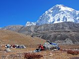
After lunch, Peak 41 (6648m) was our mountain companion to the west as we continued trekking down the Hongu Valley. The official first ascent of Peak 41 (6654m) was done on October 16, 2002 by Slovenians Matic Jost, Urban Golob, and Uros Samec. The trail follows the Hongu River and then and traverses up towards the Mera La. It took us 1:55 to trek from our lunch stop to our camp at Kongme Dingma (4770m), a wide, flat and grassy spot with a few shops and a huge boulder.
The temperature during the day was a sunny pleasant 15C, while the overnight temperature was -10C.
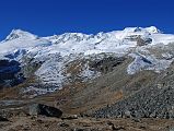
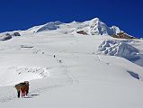
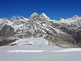
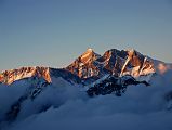
The trail continues climbing from Kongme Dingma (4770m), taking 65 minutes up an easy hill to the crest, with views of the south ridge at the end of Peak 41, Baruntse, P6770, Makalu, Kongme Dingma, and Chamlang. The trail continues climbing with excellent views of Naulekh (6363m), Mera Peak Central Summit (6461m) and Mera High Camp (5770m). The trail then zig zags for 65 minutes up to Mera Base Camp (5350m) just below the Mera La.
The trail now goes on to the glacier and quickly ascends in just 15 minutes to the Mera La (5415m) with views of Mera Peak ahead. The view to the west includes Kusum Kanguru, Peak 43 Kyashar, Kangtega poking up above the ridge, and Malanphulan. The view to the east to the Hongu Valley has several 6000m peaks including Peak 6 Mount Tutse and to the southeast Naulekh. But what dominates the view from the Mera La (5415m) is, of course, Mera Peak with the trail to Mera High Camp (5770m) snaking up the glacier and to the left, the climbing route to the left of snow ridge in shadow, Mera Peak Central Summit (6461m) in the middle of the two large snow ridges, and the Mera Peak North Summit (6476m) at the top of the right snow ridge.
The route from the Mera La (5415m) turns south and follows easy angled snow slopes, with a few steeper sections, that lead without difficulty in 85 minutes to Mera High Camp (5770m), a rocky outcrop that marks the divide between the Mera and Naulekh Glaciers. A large group already took all the campsites next to the rock, so Palde set up my tent in the middle of the trail. Pemba Rinjii and Pasang supported Palde and me at Mera High Camp.
I enjoyed the magnificent views from Mera High Camp (5770m), both at midday and at sunset, of Peak 43 Kyashar, Kangtega, Cho Oyu, Malanphulan, Ama Dablam, Nuptse, Everest, Lhotse, Peak 41, P6770, Makalu, Hongu Chuli, Chamlang, Peak 6 Mount Tutse, and Kangchenjunga and Jannu.
The temperature during the day was a sunny pleasant 8C, while the overnight temperature was -15C.
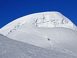
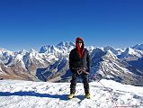
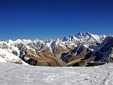
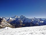
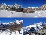
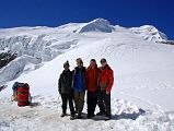
We got up at 2:45, had tea and breakfast, got prepared, and left our tent on Mera High Camp at 4:05 for the Mera summit. The weather was very good, with clear skies, no wind, and a temperature of only -15C. The first hour was fairly easy walking in just my hiking boots. As the slope increased, I put on the crampons and roped up to Palde. This was my first time in crampons, and I found the walking stiff and awkward. After two hours, I finally figured out a continuous walking style and passed most of the other trekkers who had left high camp earlier. As we neared the North and Central summits, I could see that most trekkers were turning back at the crevasse to the Central Summit. So, Palde and I ascended a small bump on the ridge at about 6350m that Palde called the Mera Eastern Summit, and took our summit photos. It took us 3:55 from High Camp.
In 2009, there was a crevasse blocking the way to both the Central and North summits, making it a mountaineering peak, not a trekking peak. A few true mountaineers used fixed ropes to climb down into the crevasse and up the other side to reach the Mera Peak Eastern Summit (6461m). The first ascent of Mera was made on May 20, 1953 by Jimmy Roberts and Sen Tenzing, who appear to have climbed the central summit. Mera Peak is the most popular trekking peak in Nepal with relatively straightforward access and uncomplicated climbing.
The view from Mera Peak is one of the best in the world with five of the world's six highest mountains visible. From the west, the view included Kangtega, Cho Oyu (#6), Gyachung Kang, Pumori, Malanphulan, Ama Dablam, Nuptse, Everest (#1), Lhotse (#4), Lhotse Middle and Lhotse Shar, Peak 38, Shartse, Peak 41, Baruntse, P6770, Kangchungtse and Makalu (#5), Hongu Chuli, Chamlang, Peak 5, Peak 6 Mount Tutse, and far off to the east Kangchenjunga (#3) and Jannu. Magnificent!
On the descent, we walked very near a deep crevasse, illustrating the potential danger we had passed in the dark hours of early morning. It was a quick 70 minutes to descend back to Mera High Camp for some soup and then another 35 minutes to get down to the Mera La (5415m). The trail follows the glacier and then descends steeply in slushy slippery snow before reaching the rocks in another 25 minutes.
The mountains above Khare (5000m) included the impressive triple-summit peak called Malanphulan (6573m). The peak directly above Khare is Peak 43 / Kyashar (6769m). After getting off the snow, it was an easy down, down, down in just 70 minutes to Khare, arriving at 12:30 After some tea, we continued on an easy trail, descending past Dig Kharka (4650m) to Tangnag (4350m), arriving at 14:30 in just 90 trekking minutes from Khare. I was extremely tired after a very long day, and just stayed in my tent the rest of the day and night.
The temperature during the day was a sunny pleasant 10-15C, while the overnight temperature was -2C.
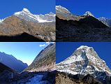
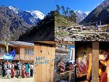
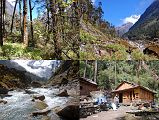
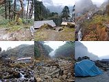
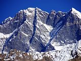
There were some very good morning views from Tangnag (4350m), including Kusum Kanguru (6367m), Peak 43 / Kyashar (6769m), and the West Face of Mera Peak. The first ascent of Peak 43 was completed by Bruce Normand, Andreas Frank, and Sam Broderick, over the West Ridge/West Face on October 18 2003. The Mera West Face is a magnificent 1800m rock face cut by diagonal snow bands and draped with fingers of ice. This was first climbed by Japanese climbers Kunihiko Kondo and Michiko Kiyoda in the spring of 1985.
The gentle trail from Tangnag (4350m) goes down the Hinku Valley on the west bank of the Hinku Khola, reaching a small gompa beneath a great rock overhang in just 27 minutes. The gompa has statues of Avalokiteshvara, Amitabha, and Padmasambhava, and paintings of a red Hayagriva, Vajrasattva in yab yum with his consort Vajratopa, Buddha, Padmasambhava, a chorten, and a blue Dakini. The gompa is looked after by one solitary, but very friendly, monk.
The trail continues down the Hinku Valley passing to the east of the Kusum Kanguru Main Summit (6367m) and the Kusum Kanguru East Summit (6356m). The first ascent of Kusum Kanguru Main Summit (6367m) was done on October 17, 1979 by Ken Kanazawa, Masanori Miyano, Hideaki Naoi, Tomoo Toyoda, Hajme Uematsu of Japan. The trail continues descending alongside the west side of the Hinku Khola with views ahead to Gonglha (5813m) and back to Kusum Kanguru and Peak 43 Kyashar.
A side valley opens to a view of Mera Peak just before reaching the surprisingly large village of Kothe (3600m) in 100 minutes from the gompa. Kothe has a few lodges, camping areas, and many shops providing meat and supplies. I paused to watch a group of young people practicing their local dances in the main field. From Kothe (3600m), the trail continues on the west side of the Hinku Khola with occasional ups and downs to our lunch stop at the few buildings and campsite at Tashing Dingma (3600m), taking one hour from Kothe.
The trail from Tashing Dingma (3600m) follows the Hinku Khola for 18 minutes, before turning west and starting the steep climb towards Tuli Kharka, reaching the few buildings of Tak Tawa after another 25 minutes, and a lodge at Thaktor (Big Rock) after another 27 minutes. The trail continues climbing steeply for another 80 minutes to a chorten at the top of the ridge, and then contours around the ridge in another 35 minutes to Tuli Kharka (4400m) with several lodges and camping sites.
The temperature during the day was a sunny pleasant 10-15C, while the overnight temperature was -3C.
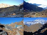
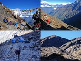
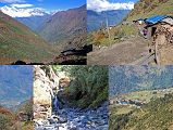
The trail from Tuli Kharka climbs in just 60 minutes to the Zatrawa La (4600m) marked by prayer flags and a chorten, with views of Karyolung, Khatang, Panaltopa, Tengkangpoche, Tengi Ragi Tau, Nupla, Kongde Lho, and Kocngde Shar. The trail contours downs and around the ridge to a second pass in another 25 minutes.
There is an excellent view from the second Zatrawa La pass to the Lunag massif next to the Nangpa La pass to Tibet. From left to right are Little Lunag (6492m), Lunag I (6895m), Lunag II (6891m), Jobo Rinjang (6778m), Lunag III (6795m), Lunag IV (6781m) and Lunag V (6550m). The first ascent of Jobo Rinjang (6778m) was completed by David Gottlieb and Joe Puryear on April 22, 2009 via the direct south face, climbing alpine style over 6 days.
The trail from the second Zatrawa La pass goes steeply down, down to Karke Ding in just 30 minutes, and then continues in another 45 minutes to Chutanga (3100m). Because you can see Lukla so close ahead, the trail from Chutanga seems to take forever as it contours around the hills and down and up to cross many streams, taking another 85 minutes to reach Lukla (2800m).
Palde and I passed the new Pasang Lhamu hospital as we entered Lukla at 11:30, enjoyed a soft drink together, and then I checked in to the comfortable Numbur Lodge, and had my first shower and real bed in over two weeks. Ah, what luxury! After dinner, I gave the crew their tips and went to my comfortable bed for a warm comfortable night’s sleep.
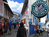
I walked down the main street of Lukla, passing the shops, restaurants, lodges, coffee shops including Starbucks, and avoiding the yaks. I walked down the main street of Lukla to a kani and an arch memorial to Pasang Lhamu marking the end of Lukla and the beginning of the trek to Namche Bazaar and beyond to Tengboche and Mount Everest.
I walked a few minutes south of the main street in Lukla to the fairly new Lukla Gompa, with statues of Buddha, Hayagriva, Padmasambhava, Mahakala, and Avalokiteshvara, and many paintings including a 1000-armed Avalokiteshvara and Hayagriva in Yab Yum with Varahi. I walked a few minutes north from the airport and visited the large Buddha statue on a hill above Lukla, with good views back to the airport and the town.
The temperature during the day was a sunny pleasant 20C, while the overnight temperature was 4C.
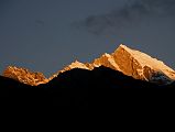
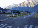
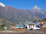
The next morning in Lukla, I watched the sunrise hit the summit of Karyolung. Planes started landing a little after 7am. They hit the upward sloping tarmac, slowed down and turned in to the terminal building. The excited trekkers quickly exited the plane and were encouraged to leave quickly by the whistle-blowing policemen.
A few minutes later the weary but happy trekkers jumped into the airplane and off they went back to Kathmandu. Nupla is in the background. I watched the planes landing and taking off while I waited until after 11am for my flight to Kathmandu, The weather was mostly cloudy, so I didn’t have very good mountain views. After the quick 30 minute flight, we landed in the 30C weather of Kathmandu. The airline offices were closed for yet another festival, so I had to call home to reschedule my flight for the next day.